
US-41: The Complete History
 With such a long and complex history, it is only deserving that one of Wisconsin's
most major thoroughfares gets its own page to detail the many decades of
changes which have occurred over the route of US-41 from 1926 to present.
For complete details on present-day US-41, however, please consult the US-41
Listing on the Highways
40-49 page.
With such a long and complex history, it is only deserving that one of Wisconsin's
most major thoroughfares gets its own page to detail the many decades of
changes which have occurred over the route of US-41 from 1926 to present.
For complete details on present-day US-41, however, please consult the US-41
Listing on the Highways
40-49 page.
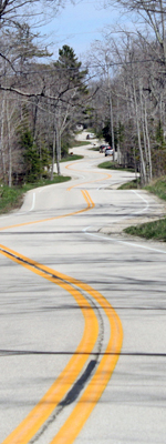
While the State of Wisconsin is home to several US Highways and four Interstates, US-41 has always seemed to outshine them all for some reason. From its inception, it has not only served the state's largest city, Milwaukee, but also serves or connects more of the state's other large cities together than any other primary route. From Racine and Kenosha south of Milwaukee to Fond du Lac, Oshkosh, Appleton and the rest of the Fox Cities up to Green Bay and Marinette on the Michigan state line. US-41 was also the first highway to see major upgrades and realignments, even before the Interstate highway system was a glint in someone's eye.
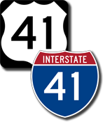
US-41 was also considered for inclusion in the original Interstate highway system in the late-1950s, but due to what seems to be a clerical or bureaucratic error at the time, it was never included. Thus, while other corridors were quickly converted to freeway status during the 1960s and 70s, upgrades came more slowly to the already-high quality US-41 route until in 2001 the final piece of the puzzle was put in place making the highway from Milwaukee straight through to north of Green Bay a full freeway. But upgrades didn't stop with that, however, and more improvements to the route are being planned.
 Finally,
in early 2005, a local US Representative inserted a provision in a transportation
funding reauthorization bill to designate the US-41 corridor between Milwaukee
and Green Bay as an Interstate facilitity to be designated as "I-41." A decade later, the I-41 designation is officially approved and Interstate route markers are erected along the route of US-41 from Illinois to Green Bay, along with a realignment of US-41 around the Milwaukee area.
Finally,
in early 2005, a local US Representative inserted a provision in a transportation
funding reauthorization bill to designate the US-41 corridor between Milwaukee
and Green Bay as an Interstate facilitity to be designated as "I-41." A decade later, the I-41 designation is officially approved and Interstate route markers are erected along the route of US-41 from Illinois to Green Bay, along with a realignment of US-41 around the Milwaukee area.
What follows is a year-by-year complete history of US-41 in Wisconsin. While I have endeavored to create as complete a history as possible, it is clear some information has either been missed or inadvertantly skipped in the process. Please drop the webmaster a line if you have any suggestions, updates, corrections or other information at chris.bessert@gmail.com.
1926 |
The US Highway system is created to reduce confusion between the dozens of already-existing and independently-numbered state highway systems around the country as well as provide for a consistently-numbered set of highway routes linking the major population centers together. Wisconsin receives several new US Highways, one of which will link Chicago with Milwaukee then continue inland, away from Lake Michigan, to serve the various cities on Lake Winnebago—Fond du Lac, Oshkosh, Neenah,Menasha, Appleton and Kaukauna—before returning to the Great Lake at Green Bay and following near the shoreline to exit the state at Marinette/Menominee. It is designated US-41. In the original system, US-141 was not initially included and early plans actually had US-41 re-entering the state along with US-2 between Iron Mountain and Crystal Falls, Michigan, however US-141 seems to have been added by the time the final US Highway system was commissioned. |
1927 |
All of the new US-41 route markers are likely posted this year when the State Transportation Commission removed the markers of the state trunk highways the new US-41 replaces. From the Illinois state line northerly into Milwaukee, the new US Highway supplants the STH-57 designation. From Milwaukee northerly, the STH-15 designation is replaced into Michigan. |
1930 |
The last segment of gravel-surfaced US-41 is hard-surfaced, from Oconto northerly to the Oconto/Marinette Co line. |
1931 |
US-41 is rerouted in downtown Appleton. Entering the downtown area via Cherry St (present-day Memorial Dr), the route formerly turns easterly via College Ave, northerly via Rankin St, easterly again via Pacific St then northerly via Leminwah St and finally easterly via Wisconsin Ave. Now, US-41 continues straight through on Richmond St northerly to Wisconsin Ave before turning easterly toward Little Chute. |
1933 |
Formerly entering the central area of Oshkosh from the south via Doty St to 16th Ave then easterly to Main St, US-41 is rerouted to enter the city via Main St solely. On the north side of Oshkosh, US-41 formerly turned westerly from Main St via New York Ave to Jackson St but now continues northerly via Main St from New York to Murdock Ave, then turns westerly via Murdock to Jackson and northerly again via Jackson toward Neenah. |
1934 |
With the addition of US-45 to the state, that route now duals with US-41 in two locations: along a portion of Main & Scott Sts in downtown Fond du Lac and from south of Oshkosh (at the present day northern terminus of STH-175) northerly through the city to the present-day jct of STH-76 & CTH-JJ/Breezewood Ln west of Neenah. |
1935 |
US-45 is removed from dualling with US-41 through downtown Oshkosh when US-45 is diverted westerly via 24th Ave for two blocks to STH-26 at Oregon Ave where US-45 and STH-26 travel northerly through the city via Oregon & Jackson Sts. US-41 & US-45 remain co-signed from 24th Ave southerly and from Murdock Ave northerly, however. Also in Milwaukee, US-41 formerly turned easterly from Layton Blvd (27th St) via Highland Ave for seven blocks to 20th St before turning northerly via 20th to Walnut St and westerly on Walnut to Lisbon Ave. Now, US-41 continues straight through the Highland Ave intersection northerly on 27th St to Lisbon Ave. |
1936 |
US-41 is realigned in southern Kenosha Co to continue due southerly from STH-43 (present-day STH-142) to the Illinois state line, supplanting the pre-existing CTH-W which formerly ran along that route from STH-50 to the state line. The former route of US-41 from STH-43 (today's CTH-S) to the state line is redesignated as STH-31. |
1937 |
The first of the major upgrades occurs along US-41 in the Fox Cities area. Beginning at Neenah, US-41 is diverted northerly via Green Bay Rd (running along present-day US-41 north of CTH-II/Winchester Rd) replacing the parallel STH-125 which followed Lake St and Butte Des Morts Beach Rd (in part) to the Winnebago/Outagamie Co line. There, STH-125 leads away from the new two-lane US-41 "bypass" into downtown Appleton via present-day CTH-BB/Prospect Ave. The new US-41 continues due northerly on brand new alignment from Prospect Ave for two additional miles to a "T"-intersection with US-10/Wisconsin Ave (now STH-96), where it turns easterly concurrently with US-10 via Wisconsin to STH-47/Richmond St. There, US-41 now turns northerly with STH-47 along Richmond for one mile to present-day CTH-OO/Northland Ave, where US-41 turns easterly to follow Northland Ave, North Ave (through Little Chute) and Hyland Ave (bypassing Kaukauna) to the present-day jct of STH-96 & CTH-JJ, where the new US-41 merges back with the former alignment. The former route of US-41 from Green Bay Rd west of Neenah through the city and into Menasha becomes an extension of STH-114, while the former route from Menasha to the cnr of Richmond St & Wisconsin Ave in Appleton becomes an extension of STH-47. From Appleton easterly to east of Kaukauna, the former US-41 (which is now part of STH-96) is turned back to local control. |
1940 |
The two portions of the two-lane "Appleton bypass" begun in 1937 are connected northwest of the city when US-41 is extended due northerly from the "T"-intersection at US-10/Wisconsin Ave for approximately one mile before making a wide easterly curve onto Northland Ave (current CTH-OO) and heading due easterly for approximately 2-1/2 miles to STH-47/Richmond St where US-41 continues easterly on the 1937 Northland Ave alignment toward Little Chute. The former route of US-41 concurrently-designated with US-10 along Wisconsin Ave from the "bypass" easterly to Badger Ave retains the US-10 designation, while the portion of Wisconsin from there easterly to Richmond St is turned back to local control. (This is now part of STH-96 today.) The one mile of Richmond St which had been US-41/STH-47 remains STH-47. |
1948 |
The two-lane, undivided "Appleton bypass" is extended on the south: From the intersection of Green Bay Rd & STH-114 on the west side of Neenah, US-41 is routed onto an all new alignment following its present-day route south-southwesterly back to the existing route of US-41/US-45 (today's STH-76) north of Oshkosh on the boundary between the Towns of Oshkosh and Vinland. The north-south portion of the former alignment of US-41 remains part of US-45, while the angling segment along Breezewood Ln is turned back to local control. |
c.1950 |
US-41 is realigned at De Pere to effectively bypass the center of the city. Travelling through the Town of Lawrence, US-41 approaches the De Pere via present-day Lawrence Dr and formerly turned easterly via Red Maple Rd before bending back northeasterly taking Lost Dauphin Rd and 3rd St into downtown where the route turned westerly via Main St to 8th St where it headed northerly toward Green Bay. The new, two-lane undivided route follows present-day Lawrence Dr from Red Maple Rd northeasterly directly to Main St where it turns easterly for three blo cks to the former route at 8th St. (The portion of the new bypass from just north of present-day CTH-F/Scheuring Rd to Main St runs directly underneath the modern day US-41 freeway.) The former route is turned back to local control. |
1951 |
US-41 undergoes further realignment in the Town of Lawrence just southwest of De Pere, this time from just south of CTH-S/Freedom Rd where the highway now veers a bit to the north (following its present-day alignment) from that point, parallel to Lawrence Dr less than a mile to the northwest, merging with the earlier "bypass" at CTH-F/Scheuring Rd closer to De Pere. The former route of US-41 along Lawrence Dr from just south of CTH-S to just north of CTH-F is turned back to local control. |
1952 |
Another major segment of US-41 is completed and opened to traffic on a completely new two-lane, undivided alignment, this time beginning at STH-23 on the west side of Fond du Lac and proceeding northwesterly, then due northerly bypassing a portion of Oshkosh to the west, ending at STH-21 west of the city. The portions of STH-23 at Fond du Lac and STH-21 at Oshkosh between the new and old alignments of US-41 are pressed into service as temporary routings for US-41 itself while further extensions on either end are being constructed. The former route of US-41 from US-45 in Fond du Lac northerly to US-45 south of Oshkosh becomes an unsigned state highway, as does the potion of Main St and Murdock Ave in Oshkosh formerly signed as US-41 between US-45 junctions. |
1953 |
The US-41 corridor upgrades continue and preparations for further changes are made. On the south, US-41 now departs Appleton Ave in the Granville area (present-day northwest Milwaukee) to head northerly with US-45/STH-100 for a little more than a mile to just beyond Fond du Lac Ave where the both US-41 and US-45 now depart via a new, two-lane unvided highway alignment parallel to Fond du Lac Ave on the north (along the same alignment as present-day US-41/US-45). The combined US-41/US-45 continue northwesterly then northerly for a short distance on new alignment past Menomonee Falls to a new junction where US-45 continues northerly merging back with its previous routing south of Jackson. The new-alignment US-41 then bends back northwesterly toward Sligner, where the new highway temporarily ends at STH-60 and the US-41 route turns westerly for one mile back to its former route. Not only is the former route of US-41 from Milwaukee Co northwesterly to Slinger redesignated as STH-175, but the new STH-175 designation is also extended northerly co-signed with US-41 through Addison and Lomira to Fond du Lac where the STH-175 designation then travels the length of the recently-removed US-41 designation from Fond du Lac via Van Dyne to US-45 south of Oshkosh. From there, the new STH-175 duals with US-45 into Oshkosh where STH-175 again takes over the former route of US-41 removed the year prior via Main St and Murdock Ave, terminating at the jct of US-45 & STH-21 on the north side of the city. |
|
The 1953 improvements on the north consist of a new bypass of Green Bay and a short "cut-off" at De Pere. First, at De Pere, the 1950 De Pere "bypass", which ended at a "T"-intersection at Main St on the west side of the city. The new "cut-off" route consists of a sweeping "S"-curve which gracefully merges US-41 traffic from the De Pere "bypass" back into Ashland Ave on the north side of the city. Second, at the southern Green Bay city limit, the new Green Bay "bypass" begins at Ashland Ave and continues westerly via present-day Lombardi Ave for approximately 1-1/4 miles before curving northerly onto Military Ave to run up the west side of the city, intersecting the existing US-41/US-141 route along Velp Ave on the the west city limit. Part of the former route of US-41 into Green Bay is redesignated as part of STH-32, while the portion formerly dualled with US-141 retains that designation. |
1954 |
Two additional US-41 corridor improvements close one gap between earlier improvements while another begins to do just that. The major project completes a new alignment US-41 route from STH-60 at Slinger northerly to the completed segment of relocated US-41 at STH-23 on the west side of Fond du Lac. The former route of US-41 between Slinger and Fond du Lac, which had been concurrently designated with STH-175 the year before, retains the STH-175 designation. In the Oshkosh area, a 3-mile extension of the 1948 relocation extends US-41 southerly from US-45/Jackson St (present-day STH-76) southwesterly to STH-110/Algoma Blvd (today's US-45), where US-41 then temporarily follows STH-110 southerly via Algoma Blvd to STH-21/Oshkosh Ave-Congress Ave where it turns westerly to back to that portion of the relocated US-41 west of the city. The Lake Butte des Morts causeway and bridge will fill the gap between the two segments of US-41 relocated at Oshkosh. |
1955 |
The Lake Butte des Morts causeway/bridge is completed and opened to traffic, connecting the previously-completed portions of the realigned US-41 at STH-110/Algoma Blvd (present-day US-45) with STH-21/Oshkosh Ave at Oshkosh. The former (temporary) route of US-41 via STH-110 and STH-21 retains those designations. |
1957 |
A new, more-direct alignment for US-41 is completed from north of Oconto to just north of the Oconto/Marinette Co line with the former route along "Old 41 Rd" being turned back to local control. |
1958 |
By 1958, major portions of US-41 in the state had been upgraded to four-lane divided, including from the Illinois state line northerly into Milwaukee, from jct US-41, US-45, STH-100 & STH-175 northwest of Milwaukee to STH-175 south of Fond du Lac, and from De Pere to the southern end of the Green Bay "bypass." |
1959 |
Major changes come to the existing route of US-41 in Racine and Kenosha Counties when the previously-rural, four-lane divided highway section of the highway from the Illinois state line to Seven Mile Rd is converted to full freeway standards and posted as part of the brand-new I-94 route through the state. Additionally, more of US-41 north of Milwaukee is converted to four-lane divided highway: From STH-26 southwest of Oshkosh to US-45/Jackson St (present-day STH-76) north of the city, except for the Lake Butte des Morts causeway/bridge, and the "Green Bay Road bypass" segment from south of STH-114 at Neenah to north of STH-150/Winchester Rd (now CTH-II) with the conversion to freeway standards continuing northerly from there to US-10/Wisconsin Ave (present-day STH-96) at Appleton. |
1961 |
By 1961, interchanges had been constructed along the existing portions of limited-acces, four-lane divided expressway between Milwaukee and Green Bay at the following intersections: Jct US-41, US-45, STH-175 (Appleton Ave); Jct STH-145 & STH-100 (Fond du Lac Ave/Good Hope Rd); STH-60; STH-144; STH-33; STH-67; STH-175 (Main St, FdL); STH-26; STH-44; STH-21; STH-110 (present-day US-45); US-45 (present-day STH-76); STH-114; STH-150 (present-day CTH-II); and US-10 (present-day STH-96). Also in 1961, the first segment of the Stadium Freeway opens from STH-59/National Ave northerly to Vliet St in Milwaukee, not yet signed as a a portion of US-41, it would be soon. |
1962 |
Three more major changes come to the route of US-41 this year. First, in Milwaukee, the Stadium Freeway is completed from Vliet St northerly to Lisbon Ave and the US-41 designation is transferred to the new feeway. From jct STH-59/National Ave, US-41 now turns westerly via STH-59 to the southern end of the completed freeway, then northerly via the Stadium Frwy to Lisbon Ave and US-41's former route. Second, the remaining two-lane undivided section of US-41 from STH-175 on the south side of Fond du Lac northerly to STH-26 south of Oshkosh is converted to four-lane divided expressway (with interchanges at STH-175/Main St, US-151 and STH-23). Third, a bypass of a portion of the original Appleton bypass—from CTH-OO/Northland Ave northerly and easterly parallel to CTH-OO past Little Chute and Kaukauna, merging back with the existing US-41 alignment northeast of Kaukauna. New interchanges at STH-47, CTH-E and STH-55 are included. The former route of US-41 across the north side of Appleton, Little Chute and Kaukauna is turned back to county control as CTH-OO. |
1963 |
The four-lane divided highway is extended along US-41 from just northeast of Kaukauna for a few miles to CTH-U along the Outagamie/Brown Co line. In addition, a partial interchange at CTH-OO/Northland Ave is completed at Appleton. |
1964 |
The four-lane divided highway is extended farther along US-41 from CTH-U on the Outagamie/Brown Co line northeasterly to De Pere. |
1965 |
New interchanges are completed along US-41 at STH-74/Main St and CTH-YY/Pilgrim Rd in Menomonee Falls and at CTH-N northwest of Kaukauna. |
1967 |
A new interchange is completed along US-41 at Hickory St in Fond du Lac. US-41 is also realigned onto new highway bypassing the southern Oconto Co communities of Brookside and Pensaukee, with the former route being turned back to local control and the portion through Pensaukee being designated as CTH-SS. |
1968 |
The first portion of the US-41 freeway bypass of Green Bay is completed and opened to traffic from existing US-41/US-141/Velp Ave southerly to a westerly extension of Lombardi Ave. Interchanges are featured at Velp, STH-29/STH-32 and at STH-54. The former route of US-41 along Military Ave is designated STH-119, but within a year the STH-119 designation is replaced with a BUS US-41 routing. |
1969 |
New interchanges are completed in the Appleton area at CTH-BB/Prospect Ave and STH-125/BUS US-41/College Ave. With that, the portion of US-41 from CTH-BB/Prospect Ave and STH-55 at Kaukauna attains freeway status with the removal of all intersecting crossroads. (The official Wisconsin highway map at this time, though, only indicates the portion from US-10/Wisconsin Ave to STH-55 at Kaukauna as being freeway.) The Lake Butte des Morts causeway/bridge at Oshkosh is also "twinned" with the completion of additional lanes, meaning the entire "Oshkosh bypass" is now a limited-access, four-lane divided expressway. |
1971 |
A northerly extension of the US-41/US-141 Green Bay freeway bypass extends the highway northerly from US-141/Velp Ave to one mile north of CTH-B at Suamico where the new highway merges back with the existing alignment. The former route of US-41/US-141 is turned back to local control as CTH-HS. Also, US-41/US-45 from the STH-145/Fond du Lac Ave interchange in Milwaukee northwesterly to the Richfield Interchange (the US-41/US-45 split south of Jackson) attains freeway status with the removal of all intersecting crossroads. |
1972 |
The portion of US-41/US-141 from the northern end of the freeway near Suamico north of Green Bay to the US-41/US-141 "split" at Abrams is converted to four-lane, divided highway. In addition, new interchanges are completed at Ninth St in Oshkosh and at SPUR STH-32/CTH-G/Main St in De Pere. |
1973 |
The portion of US-41 from STH-44 to STH-110/Algoma Blvd (present-day US-45) at Oshkosh attains freeway status with the removal of all intersecting crossroads. |
1974 |
The US-41 freeway bypass of Green Bay is extended southerly through Ashwaubenon and connected into the northern end of the "De Pere bypass at SPUR STH-32/CTH-G/Main St. Interchanges are featured at STH-32/CTH-BBB/Lombardi Ave-Hazelwood Ln (present-day CTH-VK), CTH-GG (present day STH-172), CTH-AAA/Waube Ln-Oneida St, BUS US-41 and SPUR STH-32/CTH-G/Main St. |
1975 |
The portion of US-41 from STH-110/Algoma Blvd (present-day US-45) at Oshkosh to US-10/Wisconsin Ave (present-day STH-96) at Appleton attains freeway status with the removal of all intersecting crossroads. Interchange are also completed at STH-145 just northwest of the Richfield Interchange southwest of Jackson and at CTH-Q (the predecessor to today's US-10 EAST/STH-441) southwest of Appleton. |
1989 |
For the first time on official highway maps, the non-freeway portions of US-41 from Richfield to Oshkosh, Kaukauna to De Pere and Suamico to Abrams are shown as limited-access expressway, although these segments had been built to this standard for some time. In addition, the portion of US-41 from Peshtigo to the southern limits of Marinette is converted to four-lane, divided highway. |
1991-1992 |
The old four-lane portion of the US-41 freeway from Breezewood Ln (at Exit 129) southwest of Neenah northerly to the CTH-OO/Northalnd Ave interchange (now also STH-15 at Exit 139) is upgraded to a new, urban six-lane cross section. The current northbound lanes of US-41 in this area essentially run atop the 1959-era freeway—the new southbound lanes required expansion of the right-of-way to the west. The portion of the project from STH-441 northerly is completed in 1991, while from STH-441 southerly to Neenah required two years and is completed in 1992. |
c.1991-1992 |
An interchange at the US-41/US-141 "split" at Abrams is constructed and the portion of US-41 from the split notheasterly to the southern limits of Oconto is converted to four-lane, divided expressway standards on the existing alignment. Also, US-41 from STH-44 to the Fond du Lac/Winnebago Co line attains freeway status with the removal of all intersecting crossroads. Interchanges were also completed at CTH-OO at North Fond du Lac and at CTH-J north of Kaukauna. |
c.1993-1994 |
Interchanges are completed along US-41 in Washington and Dodge Cos at CTH-K near Slinger, CTH-D west of Kohlsville and at STH-28 near Theresa as well as a new interchange at CTH-F/Scheuring Rd near De Pere. |
c.1997-1998 |
With new interchanges and a slight realignment of the freeway at STH-49 near Lomira in northeastern Dodge Co and another new interchange at CTH-B west of Eden in southern Fond du Lac Co, the portion of US-41 from STH-145 near Richfield to CTH-OO at North Fond du Lac attains freeway status with the removal of all intersecting crossroads. |
1999 |
A new interchange is completed along US-41 at CTH-N northwest of Fond du Lac signalling that US-41 between North Fond du Lac and the Fond du Lac/Winnebago Co line attains freeway status with the removal of all intersecting crossroads. Interchanges are also completed this year at CTH-U and CTH-S in western Brown Co between Kaukauna and De Pere as well as an overpass at CTH-JJ near Kaukauna, all as part of the conversion of the Kaukauna-De Pere segment of US-41 to full freeway standards. In addition, interchanges are also completed along US-41/US-141 north of Green Bay at CTH-S (Sobieski) and at the US-41 & US-141 "split" (Abrams) as part of the ongoing conversion of the portion of US-41 from Suamico to Abrams to full freeway standards. |
1999 (Aug 3) |
Due to a compromise reached with residents of a southside Milwaukee neighborhood, WisDOT agrees not to widen US-41 along Layton Blvd to accommodate current highway standards. As such, the department works out a jurisdictional transfer of Layton Blvd from STH-24/Forest Home Ave northerly to STH-59/National Ave to local control, thereby creating a gap in the route of US-41. Therefore, US-41 is routed via I-94 from the Racine/Milwaukee Co line northerly to the Marquette Interchange in downtown Milwaukee, then westerly via I-94 to the Stadium Interchange and the pre-existing route of US-41. The former portion of US-41 along Layton Blvd/S 27th St from STH-24 southerly to I-94 is redesignated as STH-241, while the portion from STH-59/National Ave northerly to I-94 a the Stadium Interchange is redesignated as STH-341, an unsigned designation. |
2000 |
The remainder of the conversion of US-41 from Suamico northerly to Abrams is completed with a new interchange at Brown Rd north of Green Bay as well as an overpass as Northfield Rd and the addition of frontage roads which allows for the removal of all private driveway access. US-41/US-141 from Suamico northerly to Abrams is now a fully-controlled access freeway facility. |
2001 |
With construction beginning in 1999, the various improvements from Kaukauna to De Pere, such as the removal of all intersecting crossroads and the construction of frontage roads, allow this segment of US-41 to also attain freeway status. US-41 is now fully controlled-access freeway from Milwaukee northerly to Abrams north of Green Bay. |
2004 (Nov 1) |
The Interstate Bridge spanning the Menominee River and carrying US-41 from Marinette into Menominee, Michigan is closed and demolition begins. This 75-year-old structure is being completely removed and replaced with a brand new bridge on the same location. The new bridge is scheduled to open to traffic by December 1, 2005. [MDOT Press Release] |
2005 (Mar) |
U.S. Representative Tom Petri (R-Fond du Lac) inserts language into one version of a transportation reauthorization bill in the House which designates US-41 as an Interstate highway "between Interstate Route I-94 near Milwaukee and Interstate Route I-43 near Green Bay." |
2005 (fall) |
Construction on US-41 in the Fond du Lac area is expected to be completed in the fall of 2005, including the complete removal of the STH-175/S Main St interchange and all structures, replacing them with one new overpass for STH-175 over the freeway with no access ramps. The new US-151 bypass interchange just south of the former STH-175 interchange will be replacing it. In addition, reconstruction of the US-151/Military Rd interchange from a traditional cloverleaf to a conventional diamond is scheduled to be completed as well. |
2005 (Nov 22) |
The US-41 Interstate Bridge connecting Menominee with Marinette, Wisc is opened to traffic today, having been closed for nearly 13 months. The final details will be complete in the following few weeks and a ribbon-cutting ceremony is to be held in early December. [WisDOT Press Release] |
2005 (Dec 3, 3:30pm) |
The US-41 Interstate Bridge connecting Menominee with Marinette, Wisc is officially completed today with a ribbon-cutting held at the center of the bridge. This wraps up a 16-month project which saw the complete removal of the 1929 structure and the construction of a brand new bridge from the ground (er, water) up. Additional work was performed along US-41 through downtown Marinette, Wisconsin. According to Dick Lund's excellent photo-essay of the construction, the Honorary Ribbon-Cutter at the ceremony was Mrs. Catherine (VanCamp) Anderson, "who, as a girl of 12 was a holder of the ribbon which was cut to open the previous Interstate Bridge in a 1930 ceremony." |
2009 (Oct 7) |
|
2009 (Nov 19) |
|
2015 (Apr 7) |
|
Additional Information
- US-41 Listing – full information on the highway as it passes through Wisconsin.
- I-41 route listing – runs concurrently with US-41 between Illinois and Howard.
- US-41 in Michigan – from the Michigan Highways website.
 US-41 Interstate Conversion – project website from WisDOT.
- Interstate 41 – from the Interstate Guide website.
- US-41 Project –
a WisDOT website detailing the upgrades along US-41 around Oshkosh and Neenah and from De Pere past Green Bay to Howard.
- Southeastern Wisconsin Regional Planning Commission – known as "SEWRPC" or "Sewer-Pac," this organization provides basic information and planning services for the Southeastern Wisconsin Region.
- Interstate Bridge (US-41) Project – a photo-essay website detailing the complete demolition and reconstruction of the US-41 Interstate Bridge spanning the Menominee River between Marinette, Wisc. and Menominee, Mich. An excellent site by Dick Lund.