
Introduction
(Note: Some of the information on this page is slightly out-of-date and will be updated in the near future.)
According to statistics from the Wisconsin Department of Transportation (WisDOT), there are 112,362 miles of public roadway within the state of all types. Of that, 11,753 miles comprise the State Trunk Highway system, which also contains approximately 4,600 bridges, and is administered and maintained by WisDOT. Outside the state highway system, the remaining 100,609 miles of roads and streets are maintained by the cities, villages, counties and towns in which they are located.
Specifically, the state trunk highway system is comprised of 750 miles of Interstates and 11,010 miles of US- and STH-marked highways. WisDOT also notes, "While the 11,753 miles of state highways represent only 10.5% of all public road mileage in Wisconsin, they carry over 34.7 billion vehicle miles of travel a year, or about 60.5% of the total annual statewide highway travel." WisDOT has also divided the entire state trunk highway system into five "sub-systems" as detailed below:
State Trunk Highway Sub-Systems:
- Corridors 2020 Backbone Routes. This 1,550-mile network of key multi-lane routes connects major population and economic centers, and provides economic links to national and international markets (e.g., Interstates 39, 43, 90 and 94; US Highways 10, 41, 51, 53 and 151; and State Highway 29).
- Corridors 2020 Connector Routes. This 2,100-mile system of two- and four-lane highways connects key communities and regional economic centers to the Corridors 2020 Backbone routes (e.g., US Highways 2, 8, 12, 14, 61 and 61; and State Highways 13, 21 and 26).
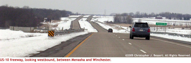
- Other Principal Arterials. These 1,450 miles of roadways provide mobility within a specific region (e.g., US-10, west of Marshfield, State Highway 35 along the Mississippi River) and serve as main thoroughfares in urban areas (East Washington Ave/US-151 in Madison; Bluemound Road/US-18 in the Milwaukee area; and, Clairemont Avenue/US-12 in Eau Claire).
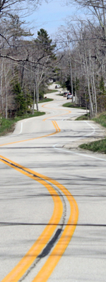
- Minor Arterials. These 5,000 miles of roadways are used primarily for trips within smaller geographic regions. They are generally rural two-lane highways that connect places of more than 1,000 people.
- Collectors and Local Function Roads. These sub-systems, totaling 1,700 miles, are used for short trips within an area and to access adjacent land.
SHP 2020. Wisconsin is currently involved in a variety of long-range transportation planning activities for all modes of transportation. WisDOT, in partnership with its stakeholders, has developed the State Highway Plan 2020, a 21-year strategic plan which considers the highway system's current condition, analyzes future uses, assesses financial constraints and outlines strategies to address Wisconsin's preservation, traffic movement, and safety needs. The plan is updated every six years to reflect changing transportation technologies, travel demand and economic conditions in Wisconsin. – Source: WisDOT.
More information from WisDOT:
- State Highway Plan 2020
- Six Year Highway Improvement Program: 2004-2009
Route Numbering. Generally the State Traffic Engineer approves assignments of state trunk highway designations. As WisDOT notes, "This does not include approval of the beginning and end and alignment of the highway, but merely the approval of the number itself." In some cases the State Traffic Engineer is asked to select a designation or a realignment of designations. As the State Traffic Engineer is a statewide position, it is perceived this manner of selecting route designations is best.
Once the route designations have been assigned, the official information on numbering, route termini, and connecting highway limits is kept in the Official State Trunk Highway System Maps compiled and published by WisDOT's Bureau of Highway Development.
Wisconsin generally adheres to the "rule" that there will be no duplication of route numbers, regardless of Interstate, US or State designation. With the coming of the Interstates in the 1950s and 60s, some state route numbers needed to be changed in order to allow I-90, I-94 and I-43 to exist in the state without duplication. The one example of a route number with two highways routings is 39. STH-39 has existed in Wisconsin since the early years, while I-39 was more recently designated as such between Beloit and Wausau.
Additional Information
For more in-depth information about the Wisconsin state trunk highway system, please feel free to explore the links in the navigation menu on the left-hand side of most pages in this website, or select from any of the items below:
- Wisconsin's Trunk Highways – additional details about the various types of signed state highways.
- Wisconsin's Route Markers – all about the various route markers in use since 1917.
- Master List: 1917-Present – the comprehensive listing of every route designation ever used in Wisconsin.
- Highway Listings – every highway is listed here with facts about each.
- Wisconsin State Trunk Highway Map – find highway listings via a map of the entire highway system.
- Historical Overview – historical highlights about the Wisconsin state highway system.
- In Depth: News & Articles – in-depth stories, histories and information.