
Proposed US-8 (Pembine-Hermansville)
The originally-certified route for US-8 was to have run easterly from Pembine, Wisconsin across the Menominee River and into Michigan, merging with US-2 at Hermansville, Michigan and continuing concurrently with US-2 to a terminus at jct US-2 & US-41 in Powers. This proposal lasted at least through the 1950s but was never constructed and the terminus of US-8 remains at Norway, Michigan.
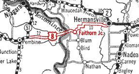
A portion of the 1927 Michigan Auto Trails road map from Rand McNally shows
US-8 as running between Pembine, Wisconsin and Hermansville, Michigan. This
was very likely wishful thinking on the part of Rand McNally, as there is
no evidence a highway bridge has ever crossed the Menominee River at that
location.
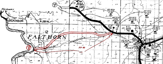
A portion of a January 1, 1938 Menominee County, Michigan map from the Michigan
State Highway Department, showing the proposed alignment of US-8 between
the Wisconsin state line and Hermansville. The "55-30" identifies
County 55, Project 30. The open-bar below it shows it is a project which
has yet to see actual contruction begin.
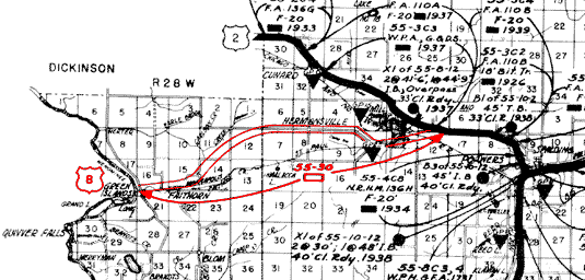
A portion of a January 1, 1945 Menominee County, Michigan map from the Michigan
State Highway Department, showing the proposed alignment of US-8 between
the Wisconsin state line and Hermansville. The "55-30" still identifies
County 55, Project 30, and shows it still has yet to see actual contruction
begin.
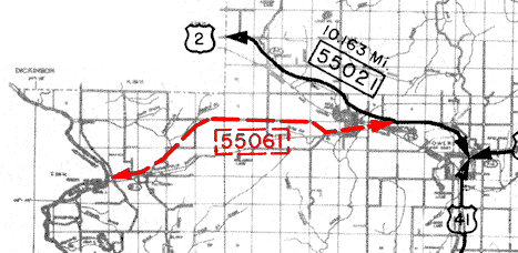
A portion of a January 1, 1959 Menominee County, Michigan map from the "Control
Section Atlas" by the Michigan State Highway Department, showing the
proposed alignment of US-8 between the Wisconsin state line and Hermansville.
The number "55061" is that highway's control section number, and
the dashed line along the proposed alignment and dashed box around the control
section number shows it is a proposed/under construction highway.
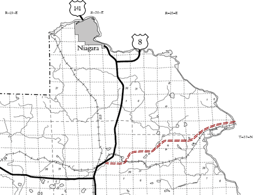
An excerpt from the December 31, 2004 "Official State Trunk Highway
System Maps" from the Wisconsin Department of Transportation, showing
that WisDOT still has the proposed route for US-8 east of Pembine as a so-called "mapped
corridor." While this does not mean the department will be constructing
the route soon—if at all—it is still interesting to see the
corridor on official maps to this day.
Additional Information
"Dedicated to the past, present and future of the Wisconsin State Trunk Highway system as well as other highways and routes throughout the Badger State. This website is intended to be a clearinghouse of information on Wisconsin's highways, from easily-recognized facts to the little-known trivia. It is also meant to change as the state highway system changes."